Region
James Bay
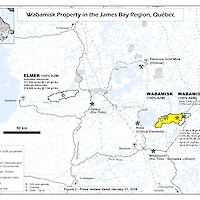
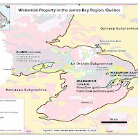
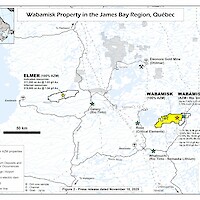
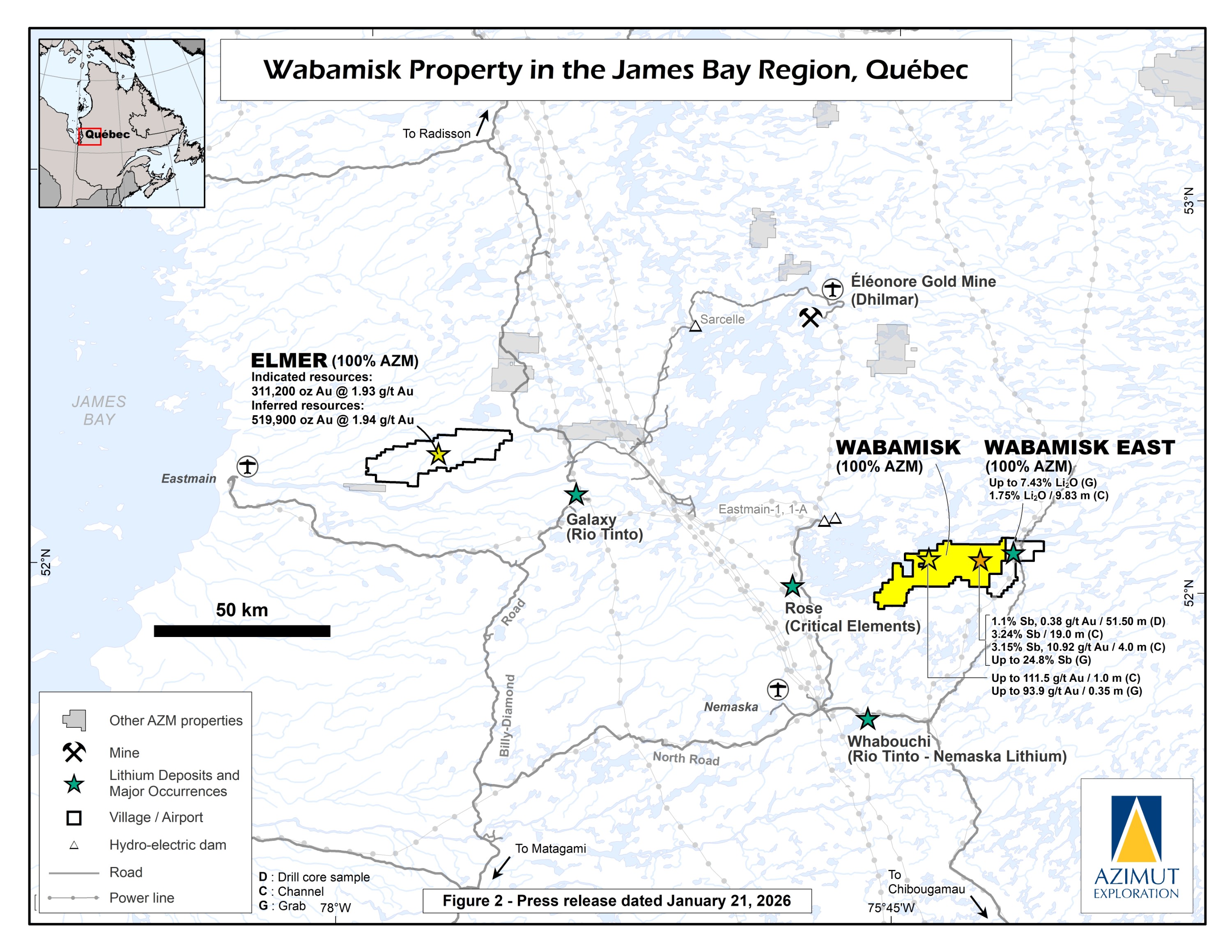
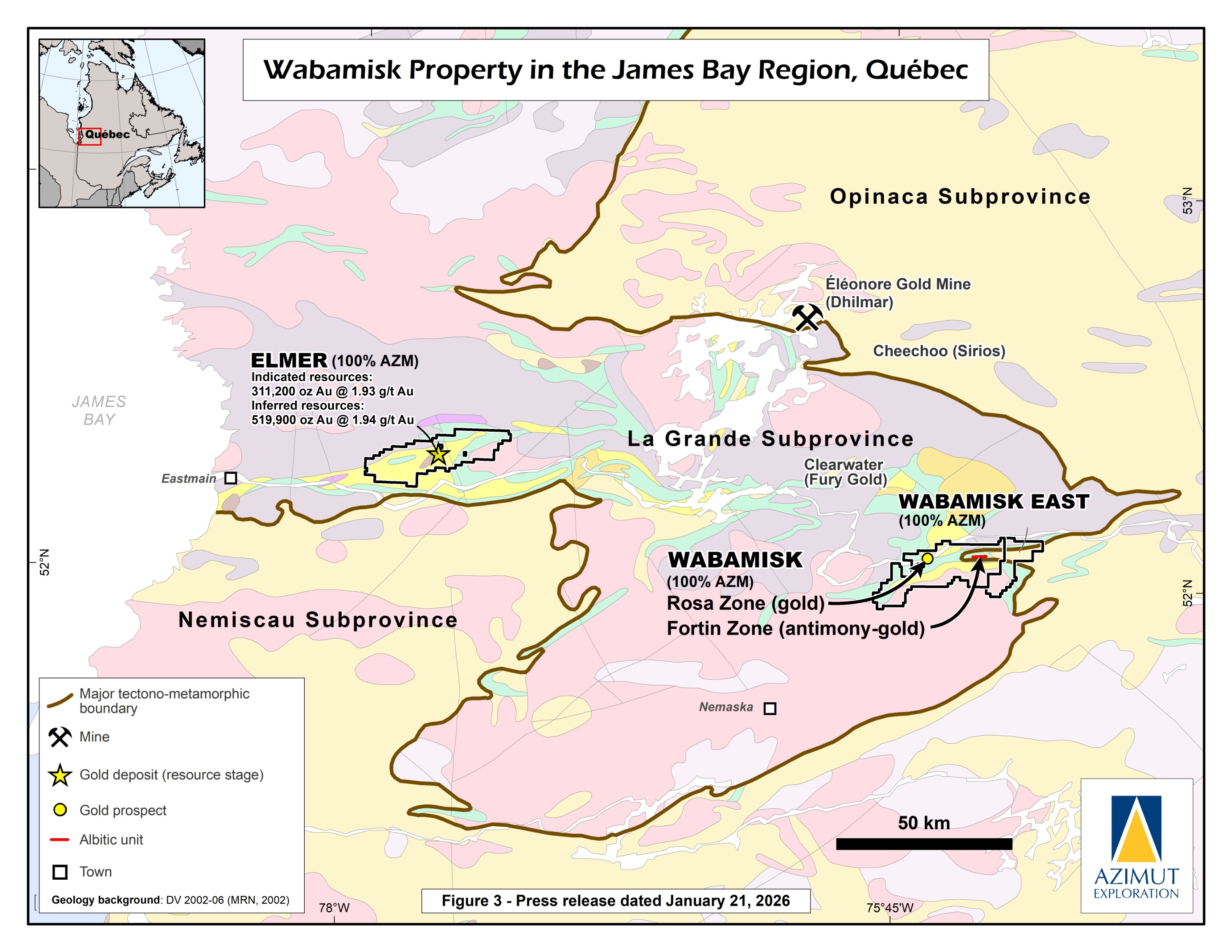
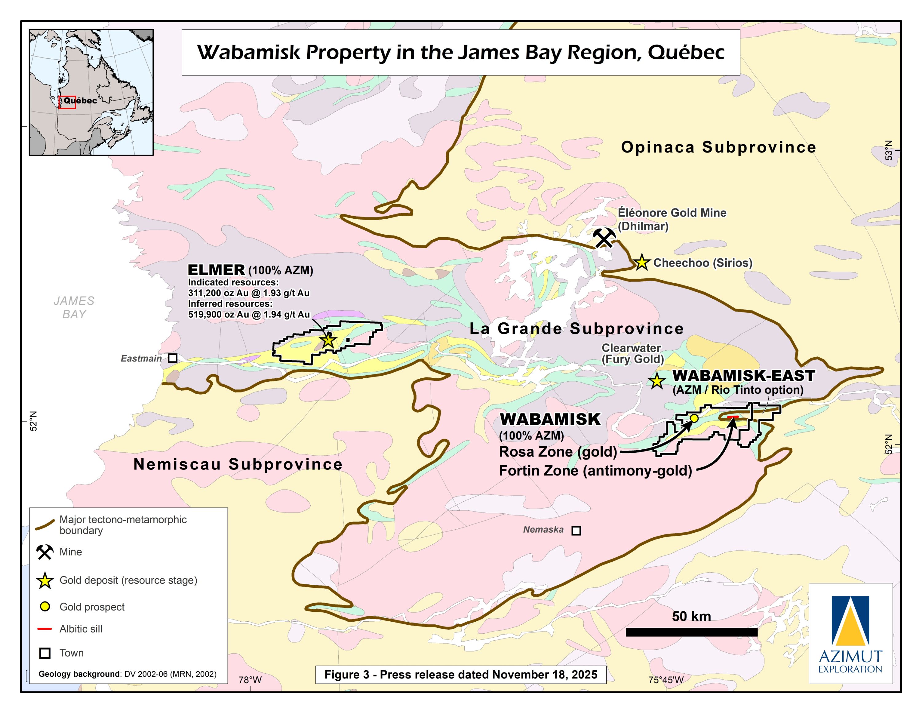
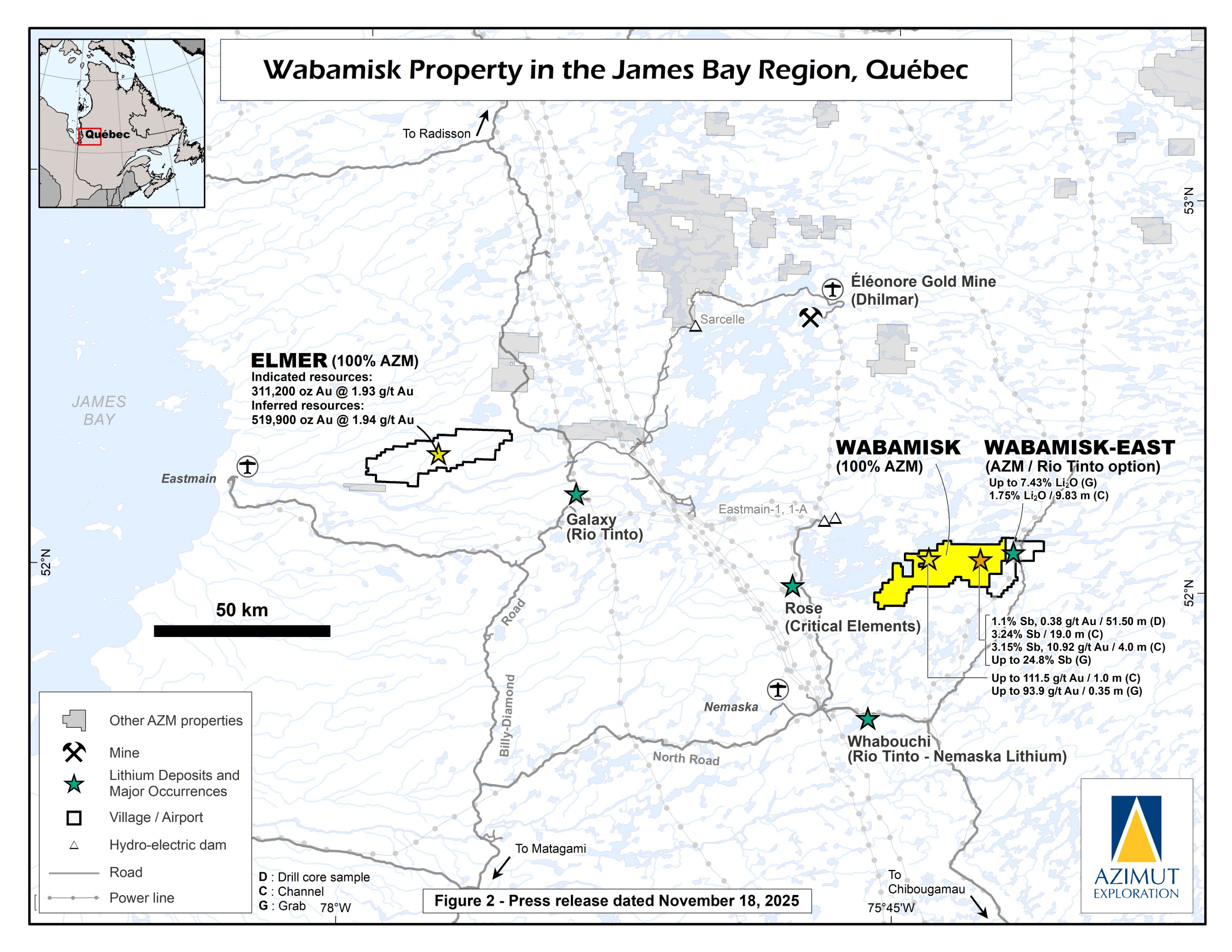
The Wabamisk property is a ~50 km by 10 km gold project located about 70 km south of the Eleonore gold mine (Dhilmar Ltd) and has a comparable geological context and geochemical signature. It is also 13 km east of the Clearwater property (Fury Gold Mines Ltd) and 42 km northeast of the Whabouchi property (Nemaska Lithium Inc.). Major powerlines pass through or close to the property's eastern end, and the North Road highway passes 37 km to the south. The nearest town is Nemaska, a Cree community, 55 km to the southeast.
Azimut initially acquired the claims by map designation in 2005 following its James Bay-scale predictive modelling for gold. Wabamisk was optioned to Placer Dome in 2005 before it was transferred to Goldcorp Inc. which was then acquired by Newmont. In 2022, Azimut announced that it regained 100% ownership of the project (PR of August 8, 2022).
Since regaining full control of the Property, Azimut reprocessed the property’s large database to rank exploration targets.
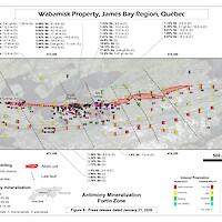
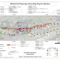
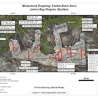
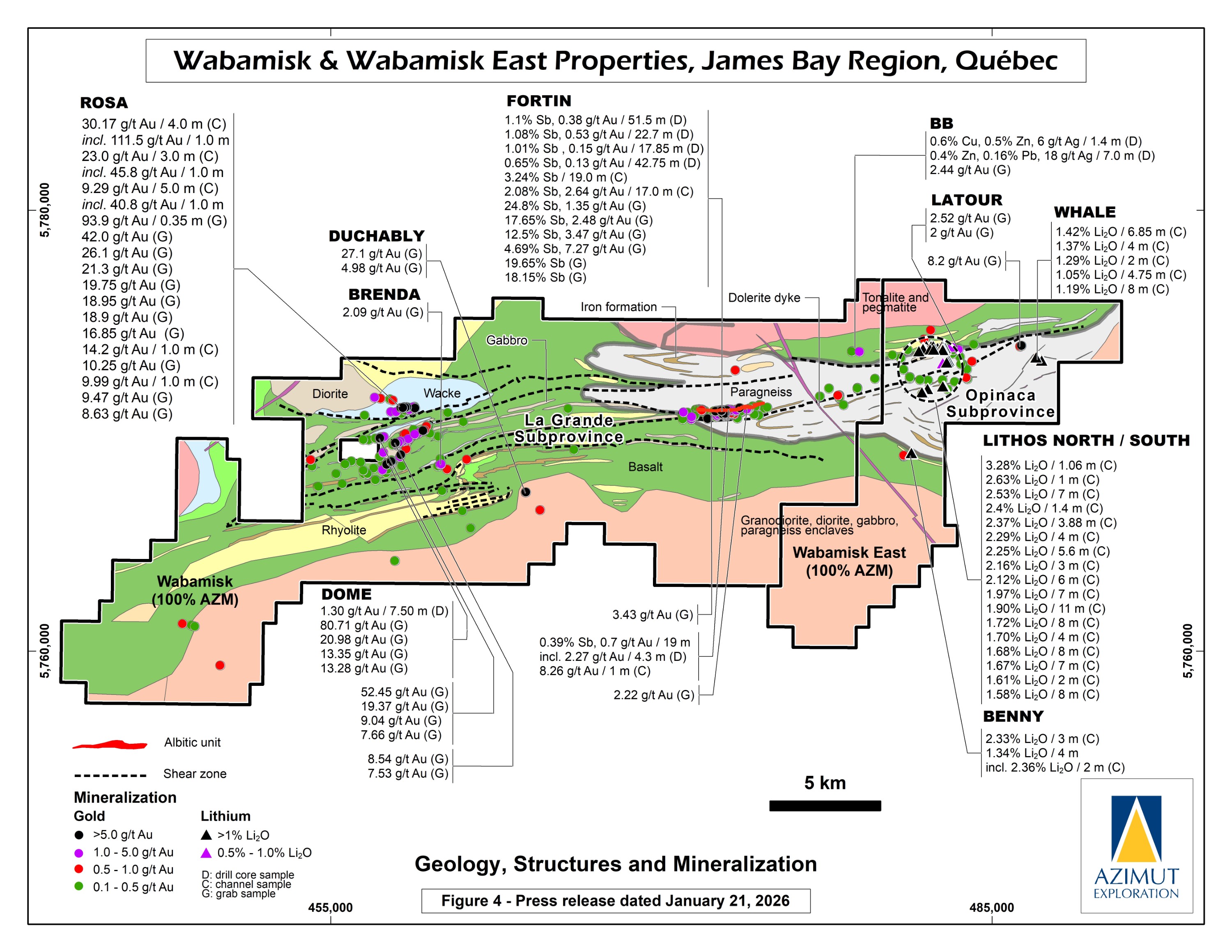
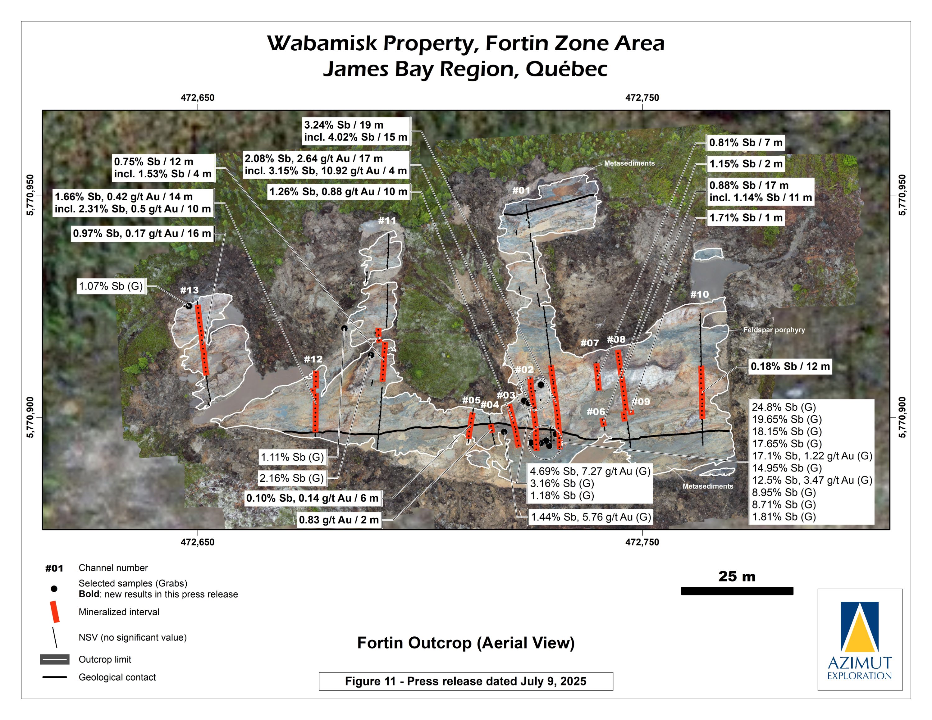
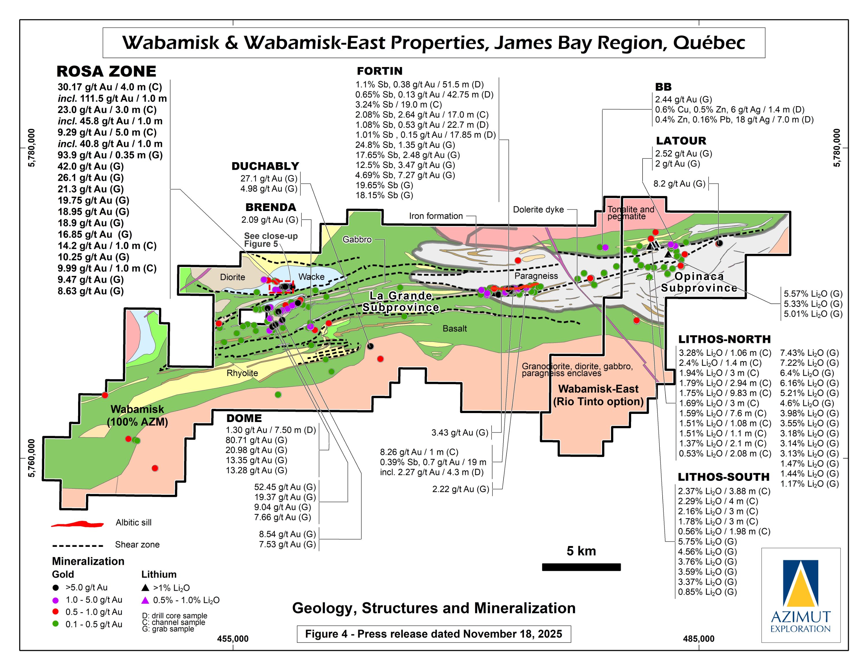
The 2024 prospecting program revealed an antimony-rich system demonstrated by channel samples (3.24% Sb / 19.0 m) and numerous high-grade grab samples (up to 24.8% Sb) collected along a 1.2-kilometre-long strike within the Fortin Zone. Gold commonly accompanies antimony.
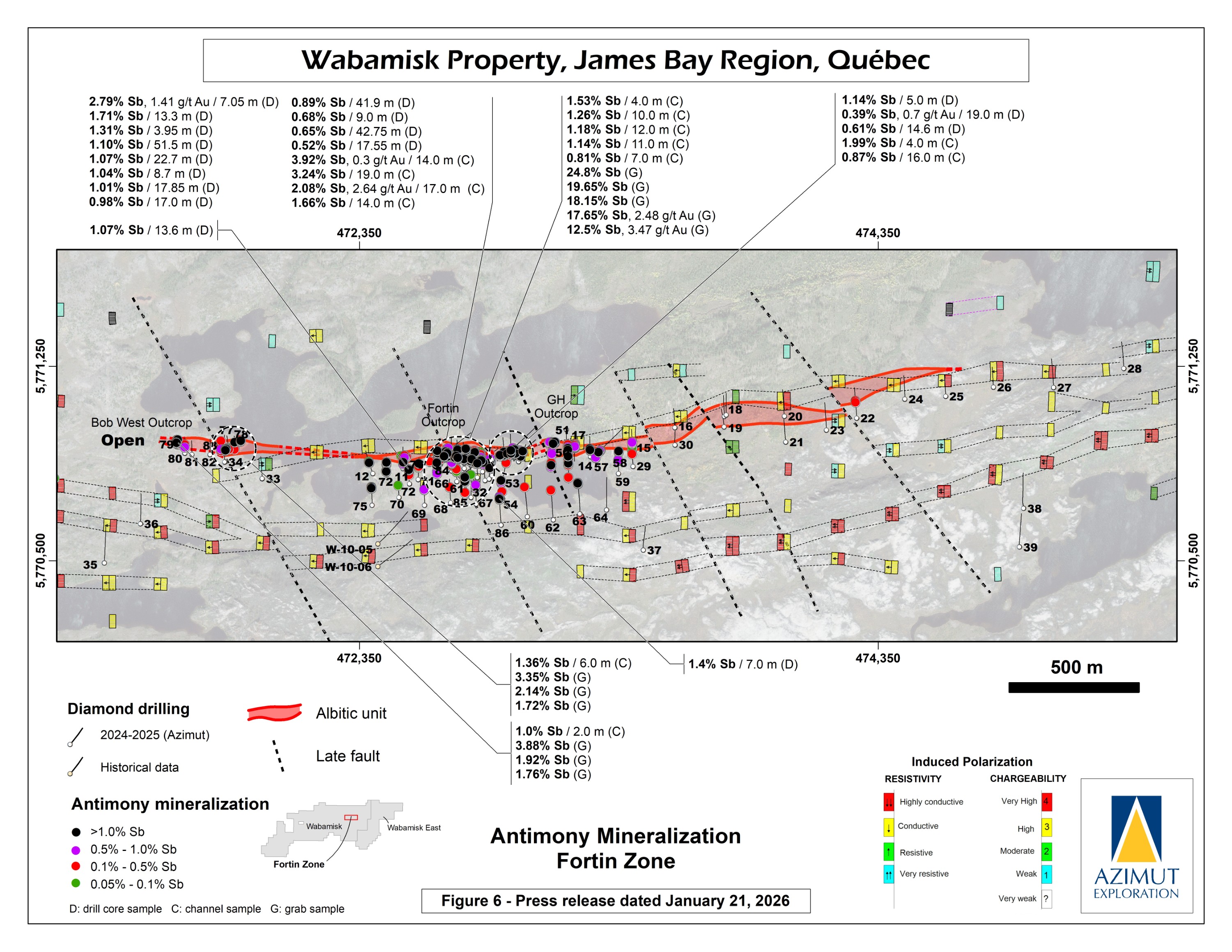
A first drilling program of 51 diamond drill holes for 6,396 m was completed in late 2024 and early 2025 on the Fortin Zone. The results confirmed the presence of a robust mineralized antimony-gold system with considerable exploration potential.
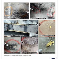
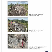
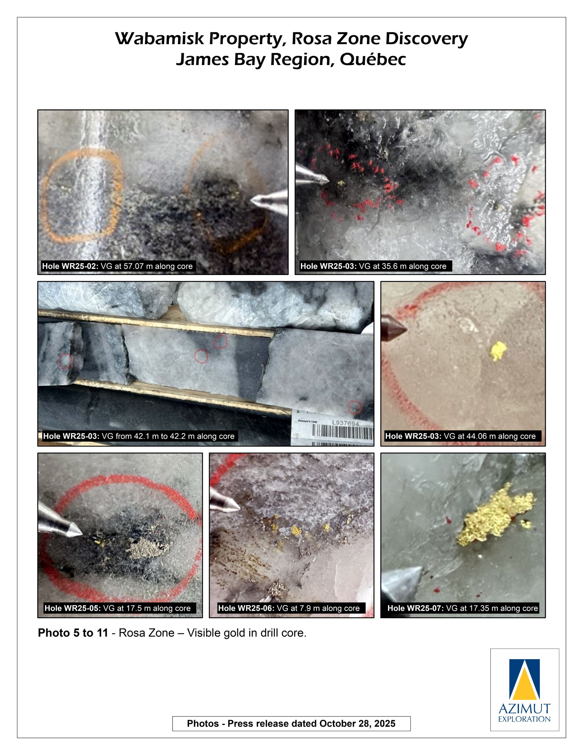
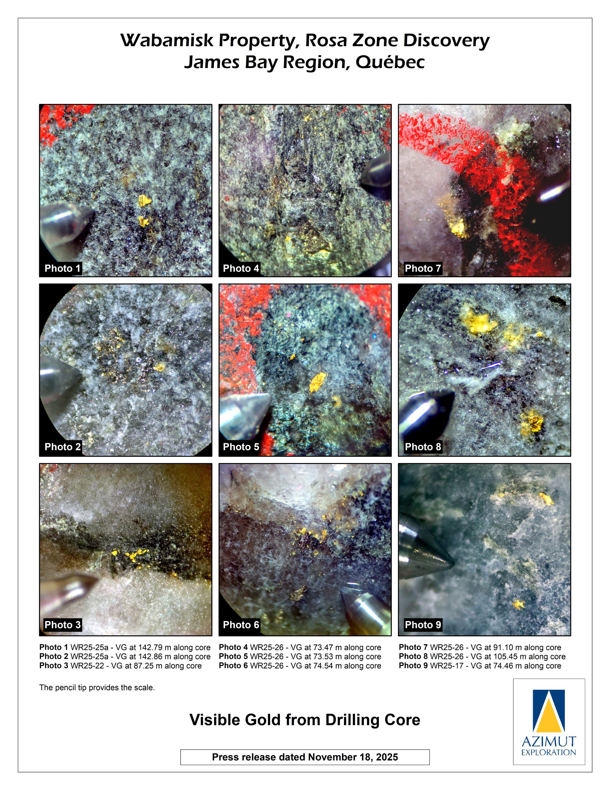
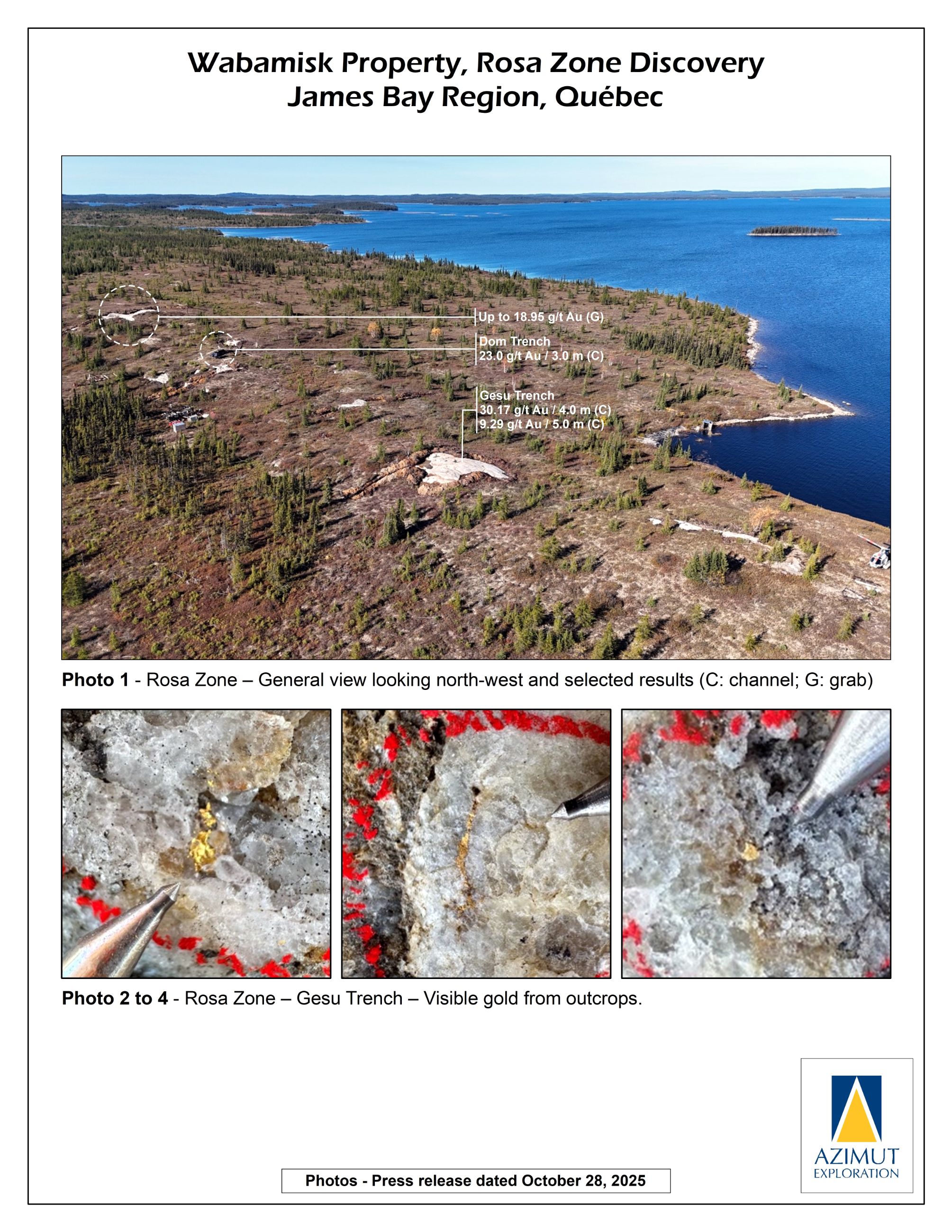
In 2025, a significant gold-bearing zone was discovered by prospecting, characterized by multiple high-grade gold results coupled with impressive occurrences of visible gold (the "Rosa Zone"). A 3,633 m maiden drill program was completed in late 2025 with a follow-up program for at least 2,000 m completed in early 2026.
Fortin Zone – Latest Results
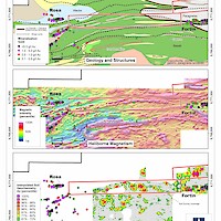
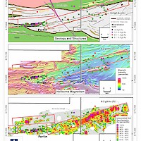
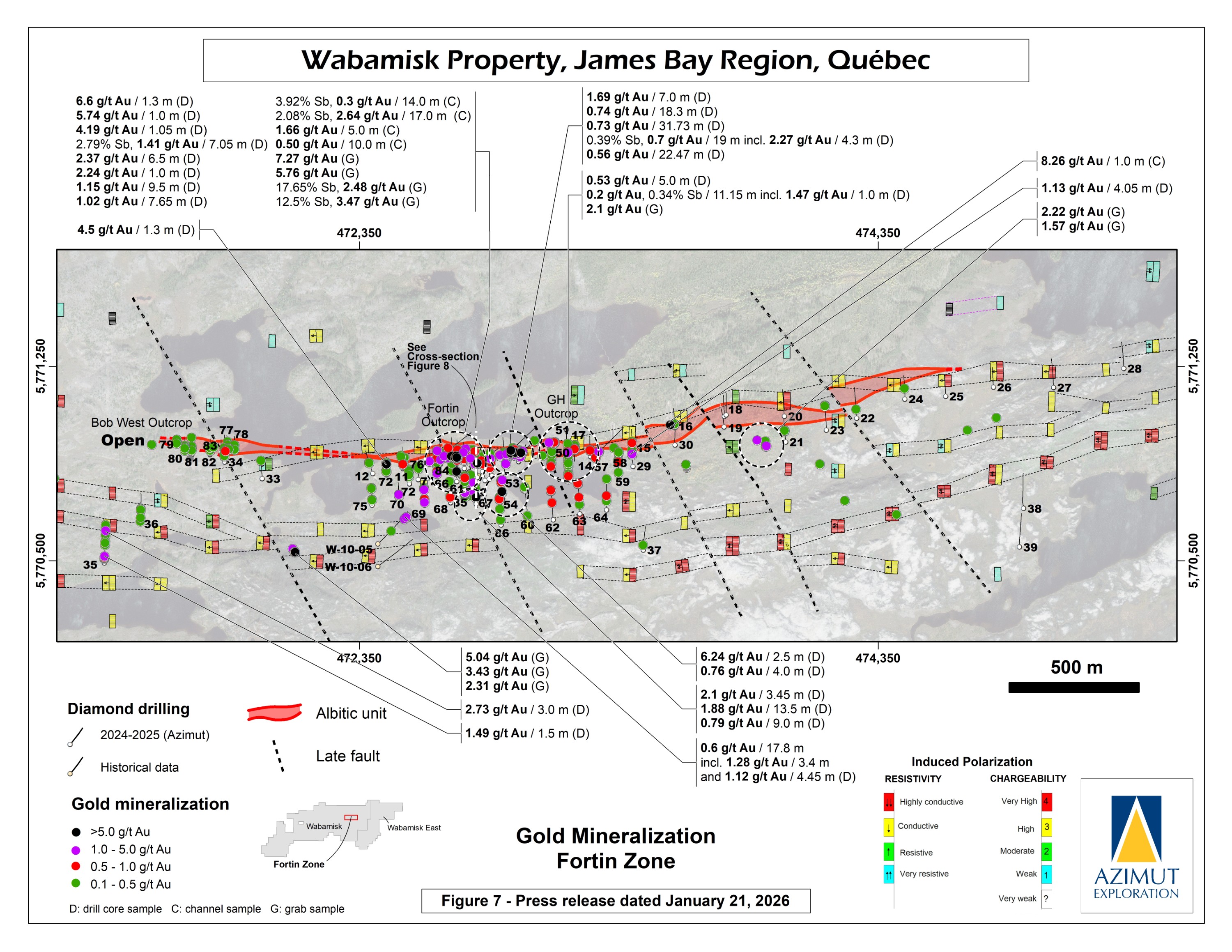
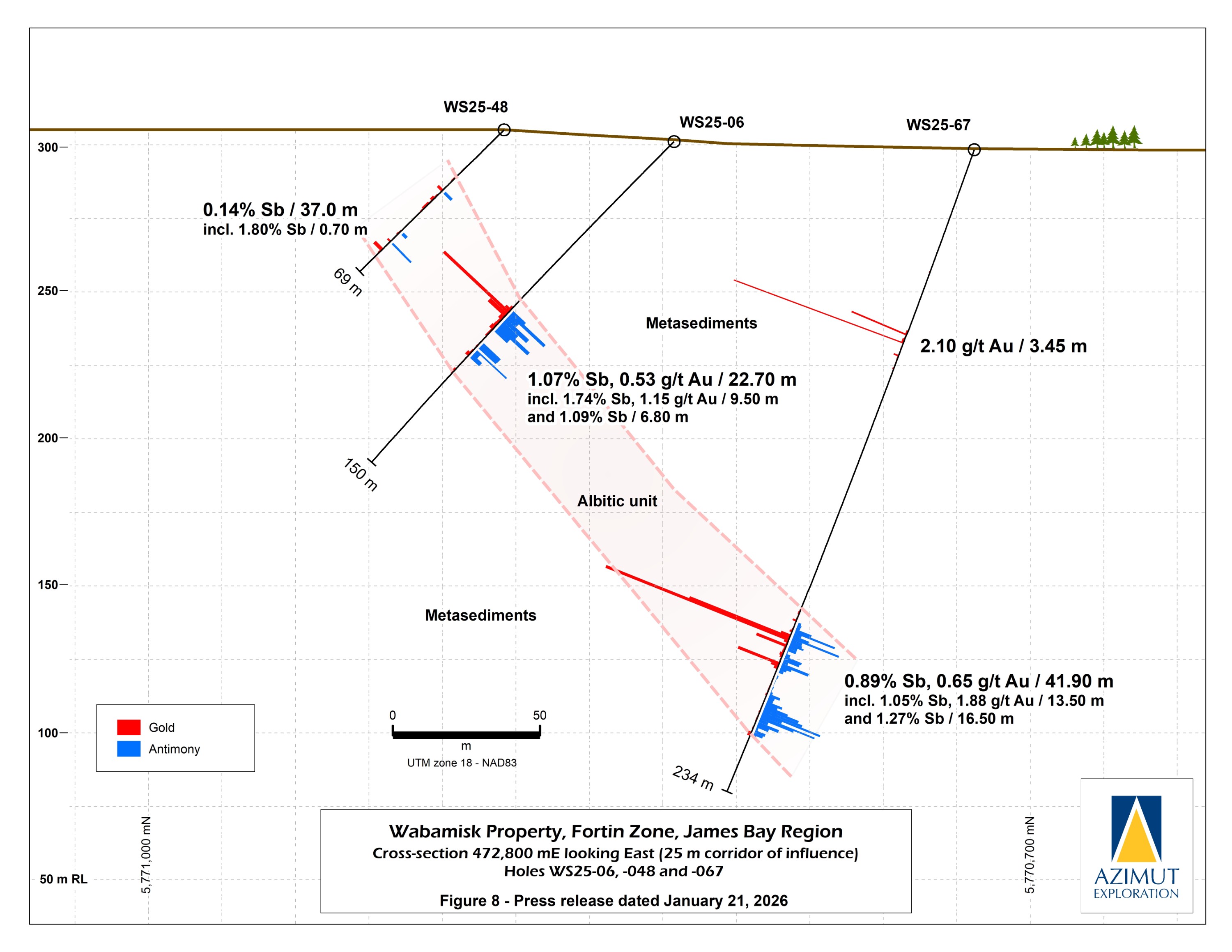
The Fortin Zone is emerging as one of Canada's largest antimony-bearing systems. Drilling to date has outlined an antimony-gold body extending 1.8 kilometres along strike and 250 metres vertically, dipping 70–75° south, averaging 25 metres thick, and remaining open in all directions. The zone is hosted in sheared metasediments at the structural boundary between the Opinaca and La Grande Archean subprovinces.
Since its discovery in 2024, Azimut has completed 86 holes (12,286 m) on the Fortin Zone and surrounding targets. The most recent program totalled 5,105 metres (27 holes) (PR March 2, 2026). The deepest hole (WS26-113) intersected the mineralized unit at approximately 515 metres vertical depth — about 200 metres below previous drilling — and encountered native gold grains at 521 metres, the deepest observed to date. This suggests the zone may exhibit antimony-to-gold vertical zonation, where higher gold grades could occur at depth, consistent with patterns documented in deposits worldwide. A preliminary 3D model of the mineralized body is in progress, and a separate gold target immediately south of and subparallel to Fortin is also being delineated by drilling. All assay results from this program are pending.
SGS Canada has been mandated to conduct initial metallurgical tests on Fortin material — including comminution testing and flotation testwork — and to carry out a market study assessing global demand for antimony mineral products
2025 - Follow-up Program to Further Delineate the Fortin Zone
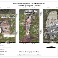
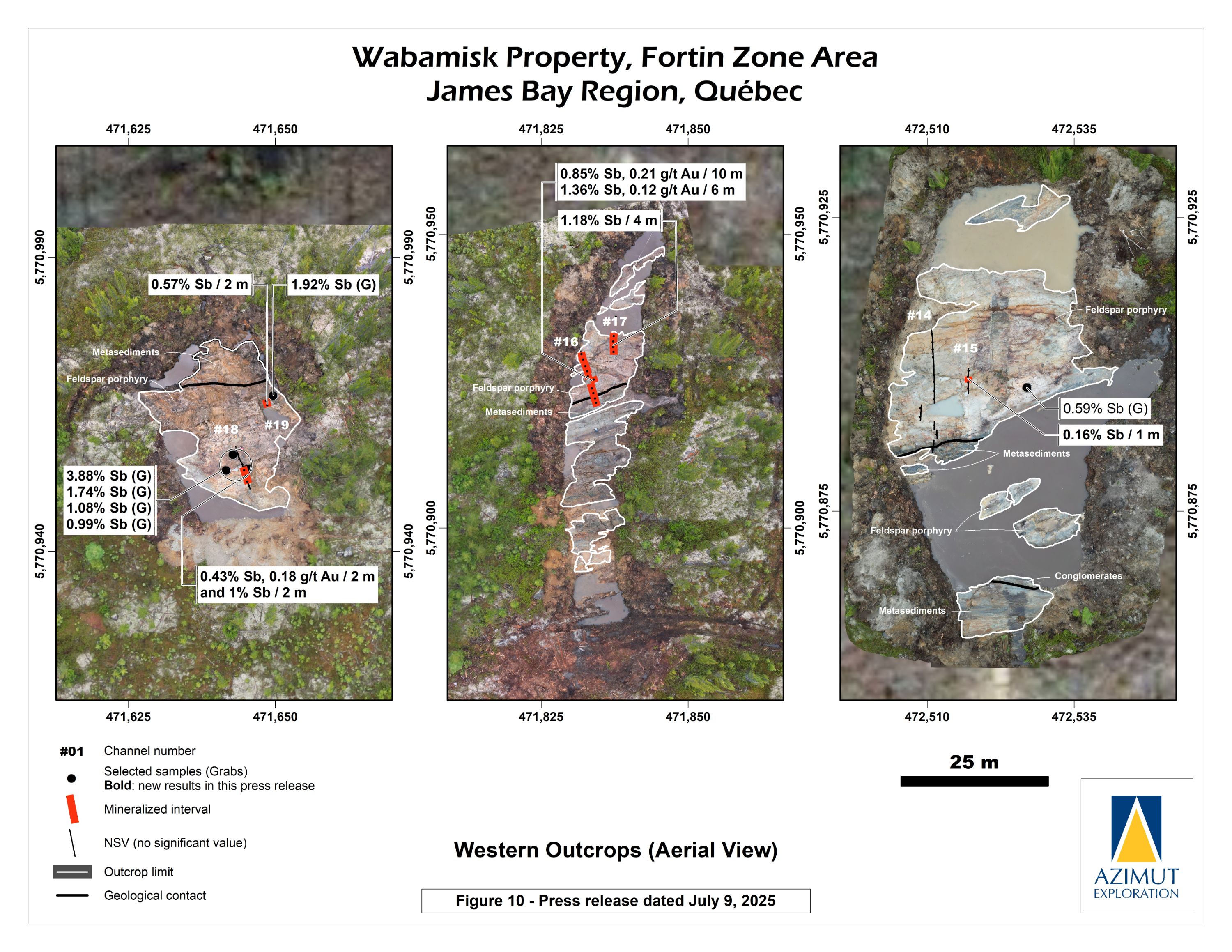
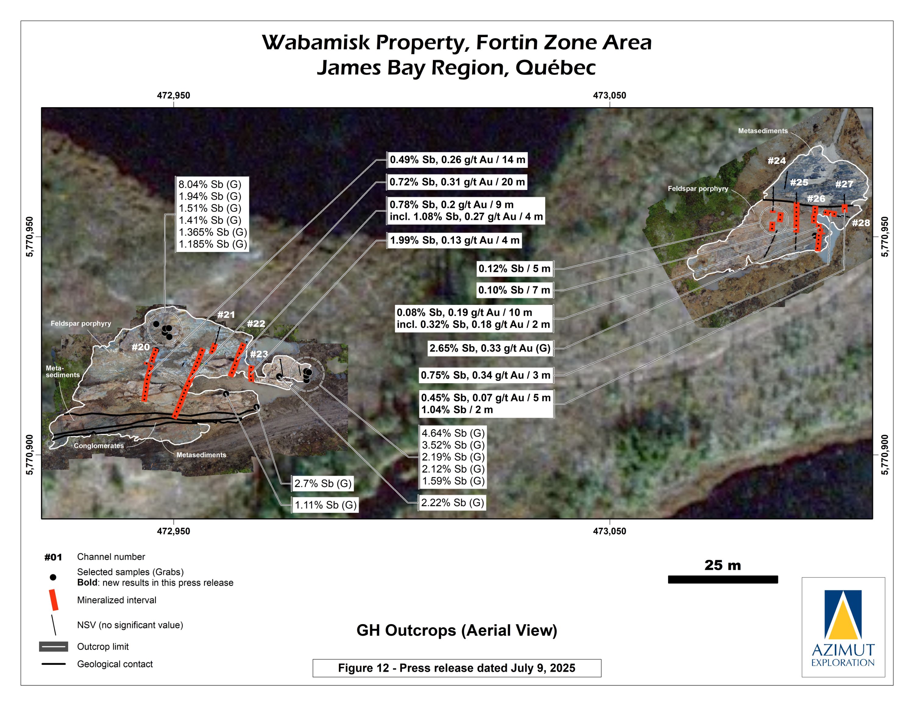
In preparation for the 2025 drill program, Azimut completed mechanical surface stripping and extensive channel sampling during the summer along the Fortin Zone. All 6 stripped areas, collectively covering 350 metres along a 1.5-kilometre east-west strike, exposed the feldspar porphyry sill and host metasediments, supporting the geometric continuity of the mineralized system.
The best results included:
High-grade gold (up to 36.5 g/t Au over 1 m in channel WS25-02) associated with antimony was also uncovered further supporting that the gold potential of the Fortin Zone may increase at depth, a pattern already observed in other antimony-gold deposits worldwide.
2025 Drill Program Goals:
2024/2025 - Initial Drill Program
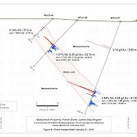
A first drilling program of 51 diamond drill holes for 6,396 metres was completed in late 2024 and early 2025. The results confirmed the presence of a robust mineralized antimony-gold system with considerable exploration potential (PR May 22, 2025).
Significant results to date:
Of the 28 holes with intervals grading more than 0.2% Sb, 15 also yielded gold intervals grading more than 1.0 g/t Au over at least 1.0 m, including 8 with grades above 4.0 g/t Au over at least 1.0 m.
The geometry of the Fortin Zone is estimated to have:
The results of this program support the preparation of the summer drilling campaign, which will include 10,000 metres of infill and expansion drilling.
2024 - Discovery of High-Grade Antimony Zone
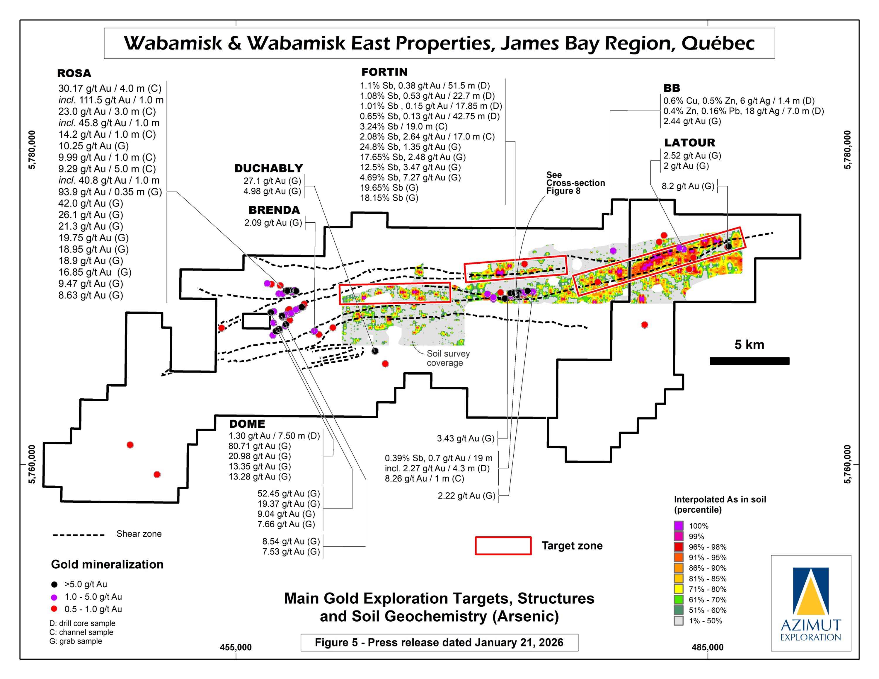
In October 2024, Azimut announced the discovery of a high-grade antimony corridor on the property with channel samples (3.92% Sb over 14.0 m) and numerous high-grade grab samples (up to 24.8% Sb) collected along a 1.2-kilometre-long strike within the Fortin Zone. Gold (up to 7.27 g/t Au in grabs) commonly accompanies antimony. Note that grab samples are selective by nature and unlikely to represent average grades. Geoscientific data (prospecting, induced polarization and magnetism, lake sediment, till and soil geochemistry) support a minimum 3.5-kilometre length for the antimony-gold exploration corridor. Significant additional work is needed to appraise its full potential.
Based on these results, Azimut proceeded with a 5,000-metre diamond drilling program to assess the corridor’s strike and grade continuity.
The 2024 summer prospecting program yielded 311 grabs and 28 channel samples. One of the objectives was to reassess a previously identified target area with known gold-antimony mineralization. 87 samples (21 from channels, 30 grabs and 36 sawed) were collected from the 1.0 by 3.5-kilometre target area. The results, which reveal significantly higher grades and better continuity than previously recognized, include 52 samples returning grades higher than 0.5% Sb:
The best channel (channel #1) returned:
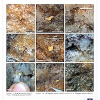
Antimony mineralization appears as semi-massive to disseminated stibnite (Sb2S3) within a multi-metre-thick envelope of intense quartz veining, mostly subparallel to the east-west schistosity, generally dipping steeply to the south. North-south multi-centimetre-thick quartz-stibnite veins also crosscut the schistosity. Arsenopyrite and pyrrhotite are also present (1% to 3%). Stockwork and brecciated facies contain the highest antimony grades. Mineralized outcrops display a dark reddish mineral named kermesite, the product of partial oxidation of stibnite.
At the outcrop scale, the mineralized zone overlaps a contact between felsic tuffs and/or a porphyritic quartz diorite sill and sheared metasediments (siltstone). The highest-grade antimony samples (above 10% Sb) seem preferentially hosted in metasediments.
Previous Activities
Initial exploration in 2005 identified several major gold target areas that included most of the known historical gold showings. Since then, a soil geochemistry survey in 2006 was followed in 2007 to 2009 by prospecting (grab sampling), mapping, IP surveys, soil sampling, channel sampling, and a maiden diamond drilling program that intersected sulphides or graphite with little or no gold.
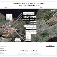
In 2010, Newmont completed an 8-hole (2,800 m) diamond drilling program that identified two prospective areas for gold in the western half of the property. The best result from six (6) holes on the GH Prospect was 2.3 g/t Au over 4.3 m within a large envelope defined by 19 m grading 0.7 g/t Au, 0.39% Sb and 0.20% As. This gold-antimony-arsenic zone is associated with a diorite intrusion and metasedimentary rocks. Mineralization is characterized by Sb and As sulphides as disseminations and veinlets accompanied by sericitization and silicification. The target zone is 3.5 km long, outlined by coincident soil (Sb, As) and geophysical (IP) anomalies. The alteration-mineralization footprint indicates strong exploration potential along strike and at depth.
The second area, the Dome-ML Prospect, is 1.7 km long and yielded several historical high-grade gold values (up to 80.7 g/t Au) in grab samples taken from sheared and altered mafic volcanic units and a dioritic intrusion.
From 2012 to 2015, Newmont funded work programs that included prospecting (651 grab samples), a soil geochemistry survey (3,890 samples), an IP survey over altered shear zones that warranted additional work, and a high-resolution helicopter-borne magnetic survey (3,502 line-km). These programs led to the discovery of a new prospective area in the western part of the property characterized by gold-in-soil anomalies and an assay of 12.45 g/t Au from a quartz vein in a grab sample. Other prospecting results included 2.42% Cu, 0.41 g/t Au and 23.6 g/t Ag (grab sample); 1.42% Cu and 7.1 g/t Ag (grab sample); and 1.01% Cu, 0.67 g/t Au and 9.1 g/t Ag (boulder).
In 2018, Newmont contracted Geo Data Solutions Inc. to fly a heliborne SkyTEM survey over the property at a line spacing of 100 m for a total coverage of 3,322 line-km. The objective was to enhance target definition by delineating high-quality conductors on the project.
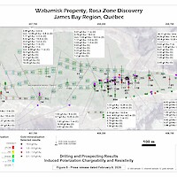
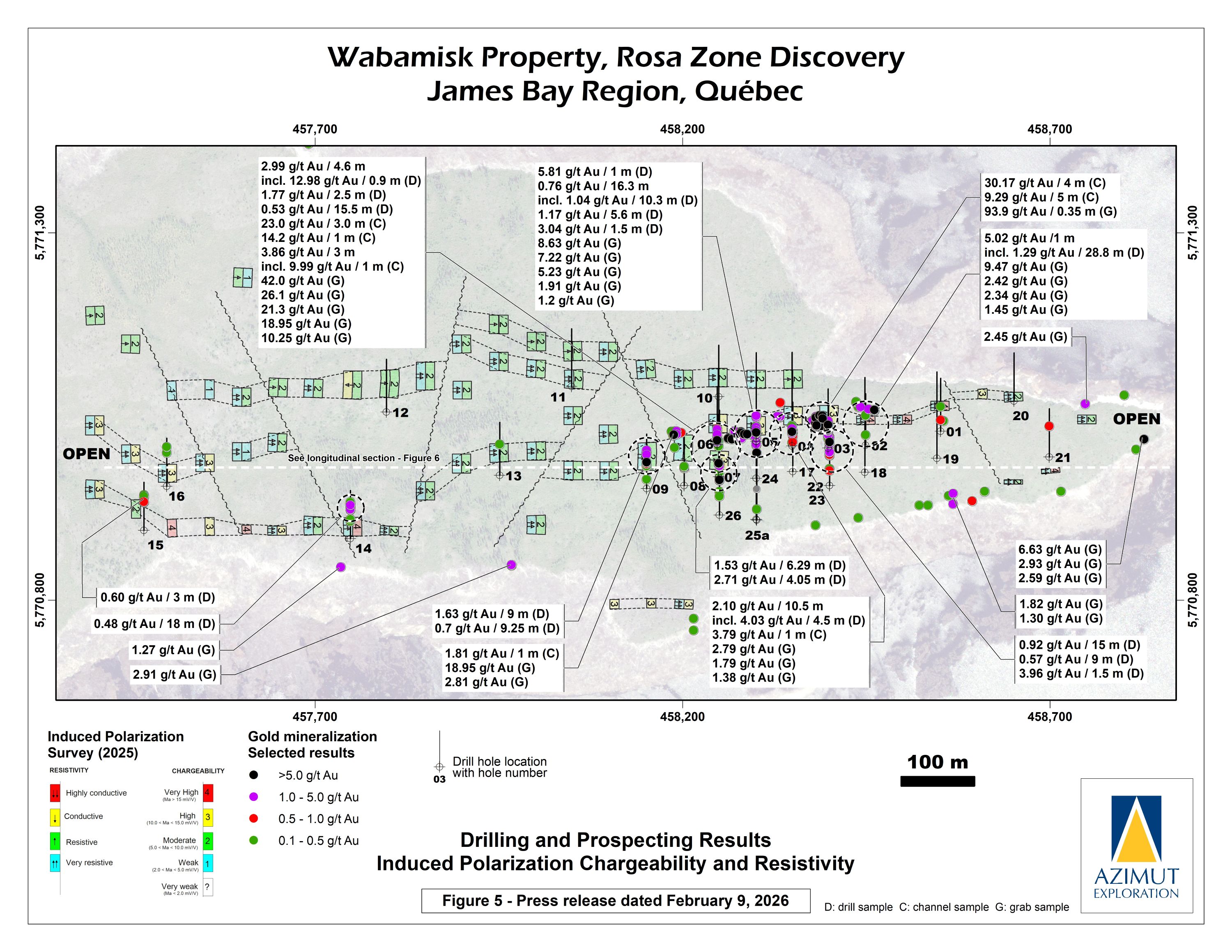
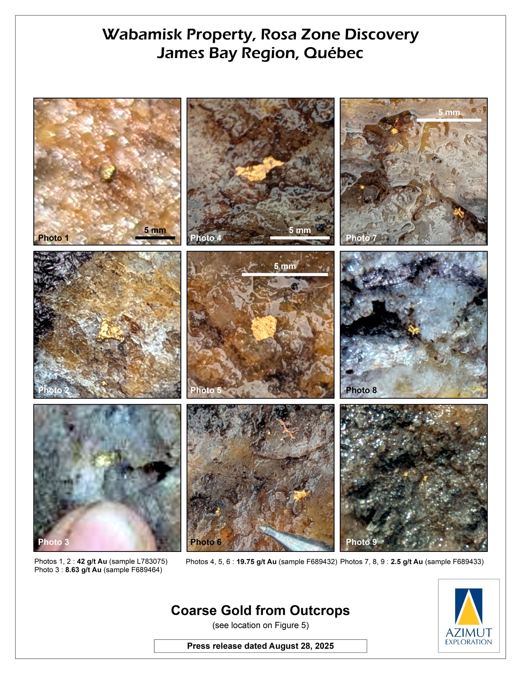
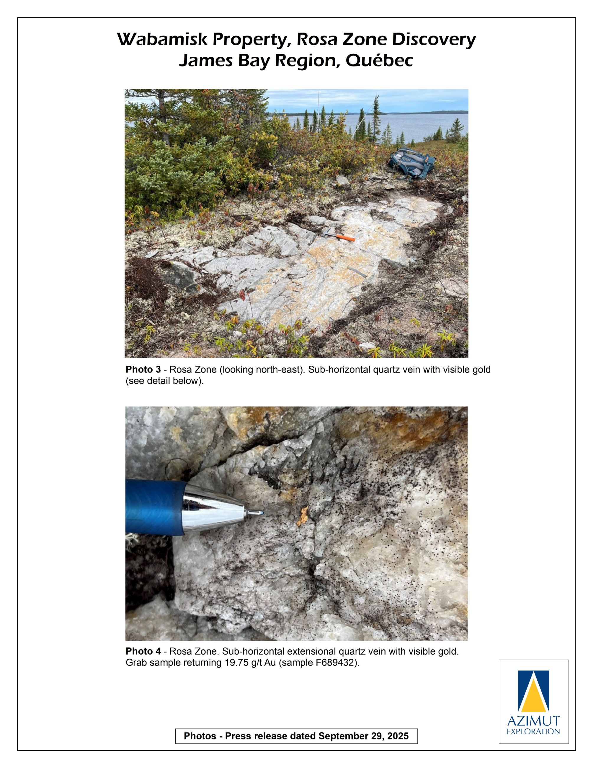
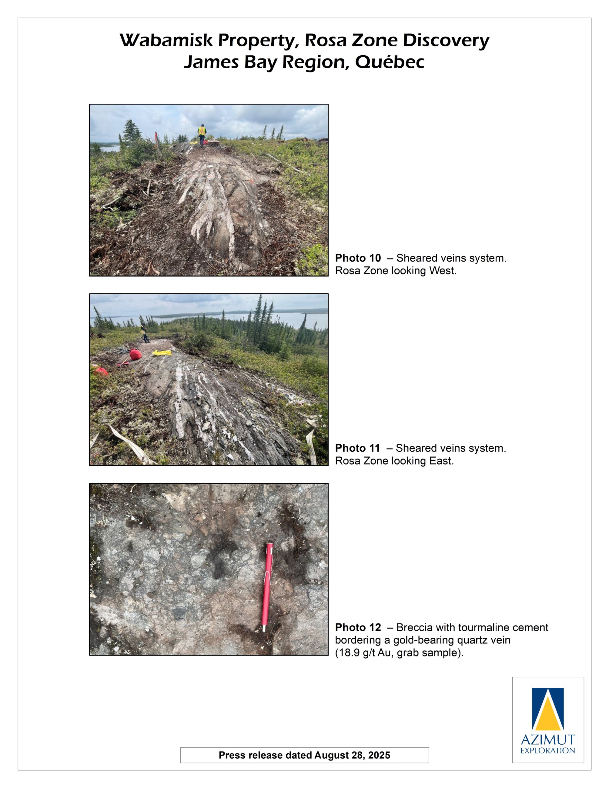
In August, Azimut reported that a significant gold-bearing zone (the “Rosa Zone”) was discovered by prospecting on its Wabamisk property. The Rosa Zone is characterized by multiple high-grade gold results coupled with impressive occurrences of visible gold. An induced polarization (“IP”) survey totalling 11 line-kilometres was quickly completed, which outlined a continuous east–west chargeability anomaly extending over 1.4 kilometres, strongly correlated with a 300-metre strike of high-grade, gold-bearing grab samples from outcrops. The survey also identified a subparallel chargeability anomaly, located roughly 50 to 200 metres to the north. Based on these results, a maiden 3,633m drill program was initiated in October to test the target.
In February 2026, Azimut reported that the initial drilling confirmed a significant gold-bearing mineralized system, which remains open along strike and at depth; furthermore, other subparallel targets remain untested. Additional upside potential is supported by the strong correlation between gold mineralization and induced polarization geophysical anomalies.
Best results include:
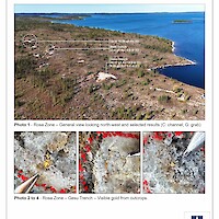
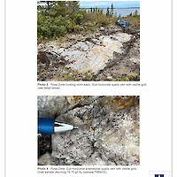
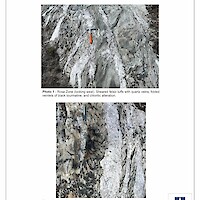
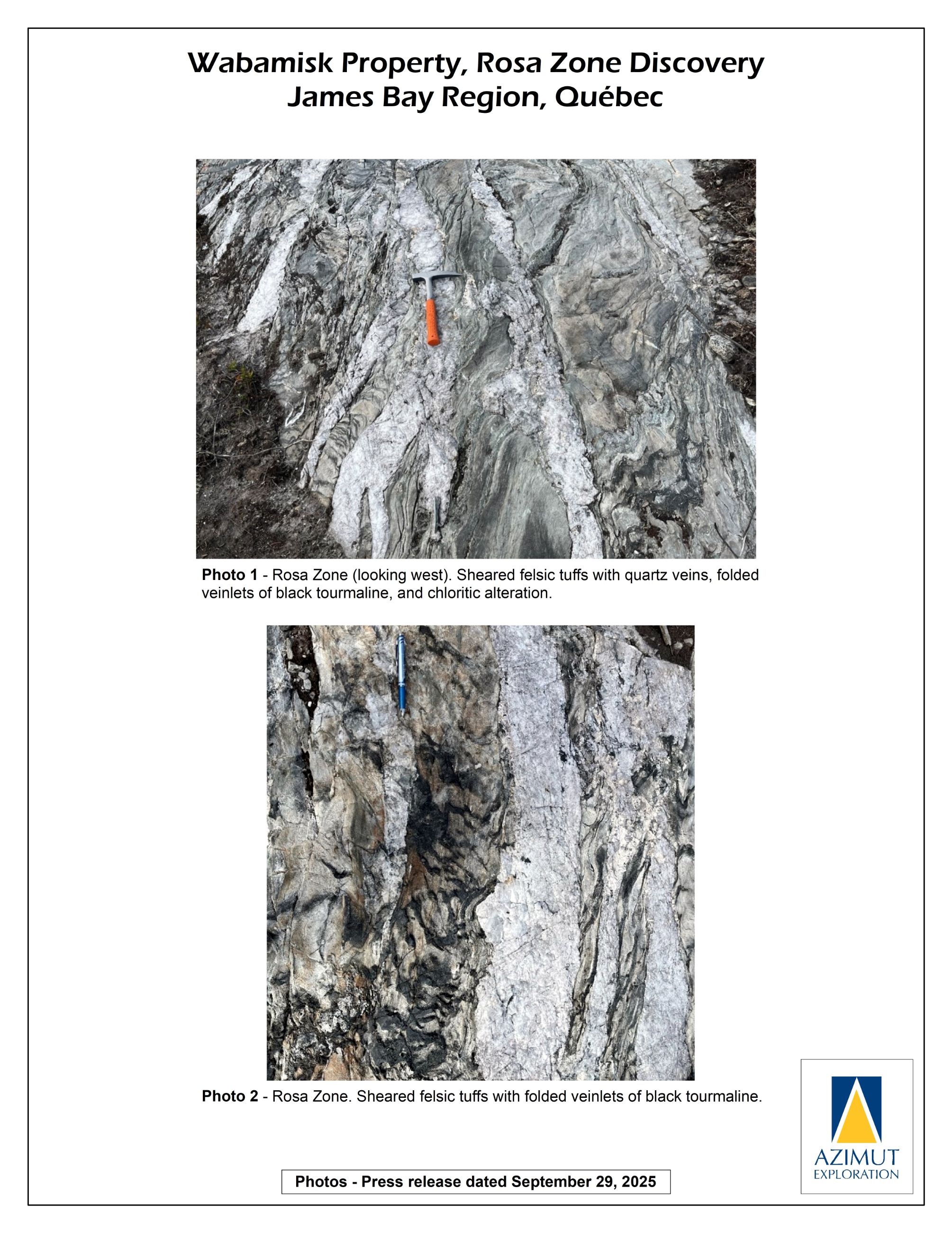
Preliminary Description of the Rosa Zone:
Mineralization and alteration
Geometry
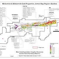
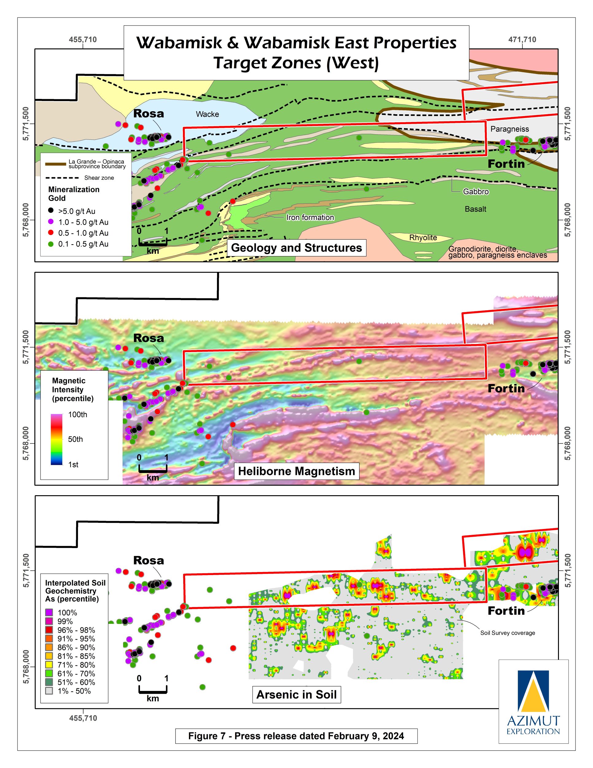
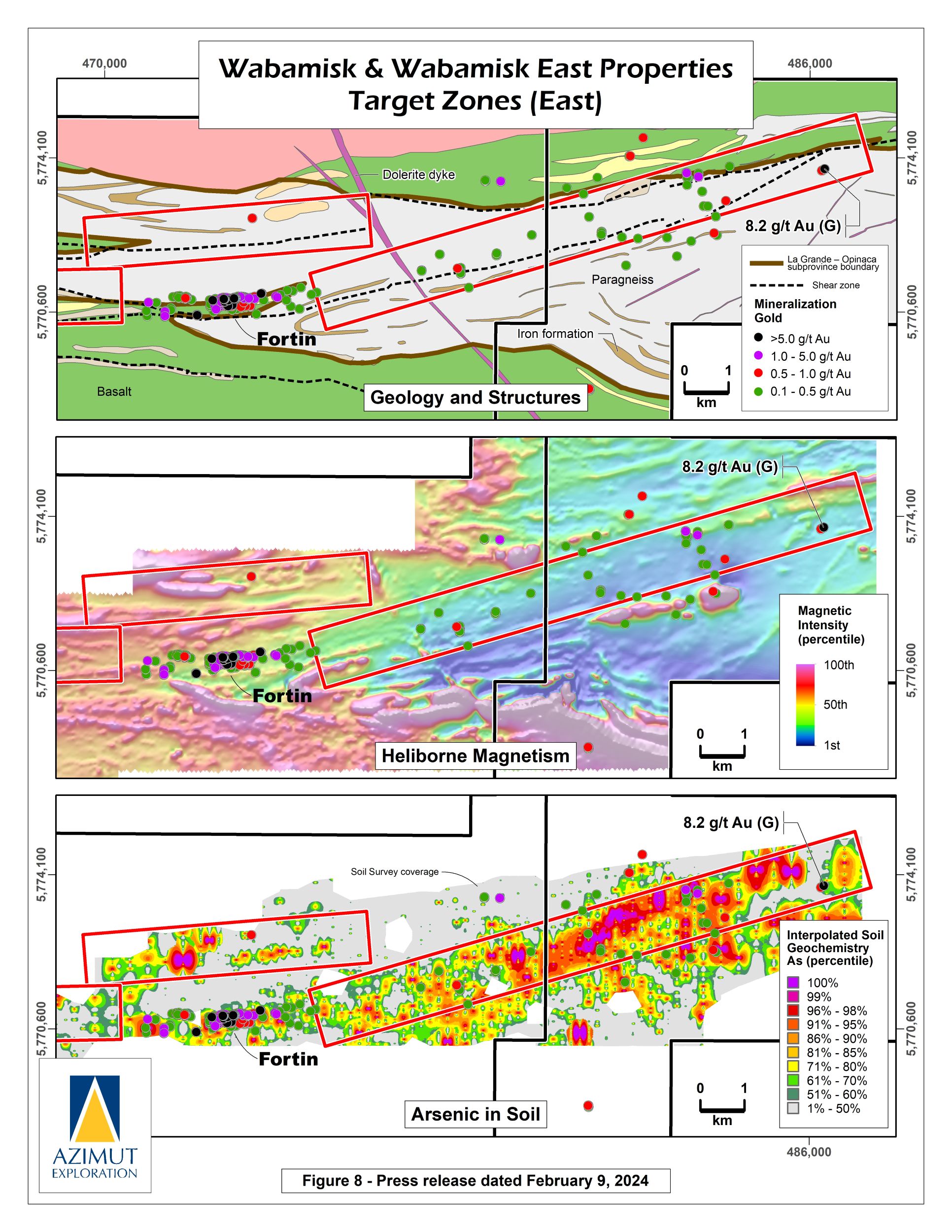
Other Major Exploration Targets
Work conducted since 2024 is driving a comprehensive re-evaluation of the property’s potential. Three underexplored major target areas stand out, having in common their strong association with east-west subparallel shear zones and strong arsenic anomalies in soil, straddling the La Grande-Opinaca subprovince boundary or entirely within the Opinaca Subprovince:
All three target areas will be subject to comprehensive work programs in 2026, including ground geophysics (induced polarization), prospecting, and likely drilling.
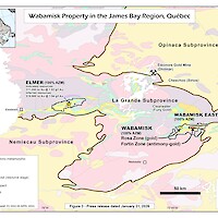
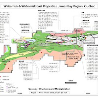
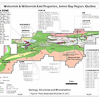
The Wabamisk property is situated in the Archean Superior Province at the contact between the La Grande and Opinaca subprovinces. This boundary is controlled by a major E-W regional deformation corridor. The property is underlain by La Grande volcano-plutonic lithologies and Opinaca metasedimentary units. Wabamisk has a comparable geological context and geochemical signature to the Éléonore gold mine.


